
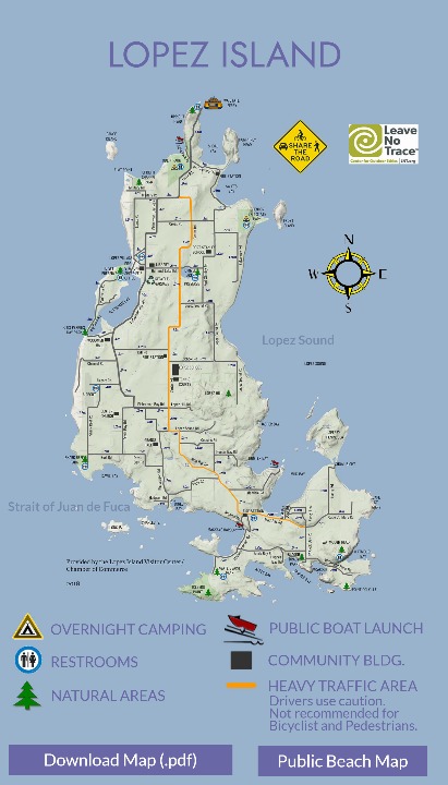


Not recommended for
Bicyclist and Pedestrians.
Lopez Sound
Strait of Juan de Fuca
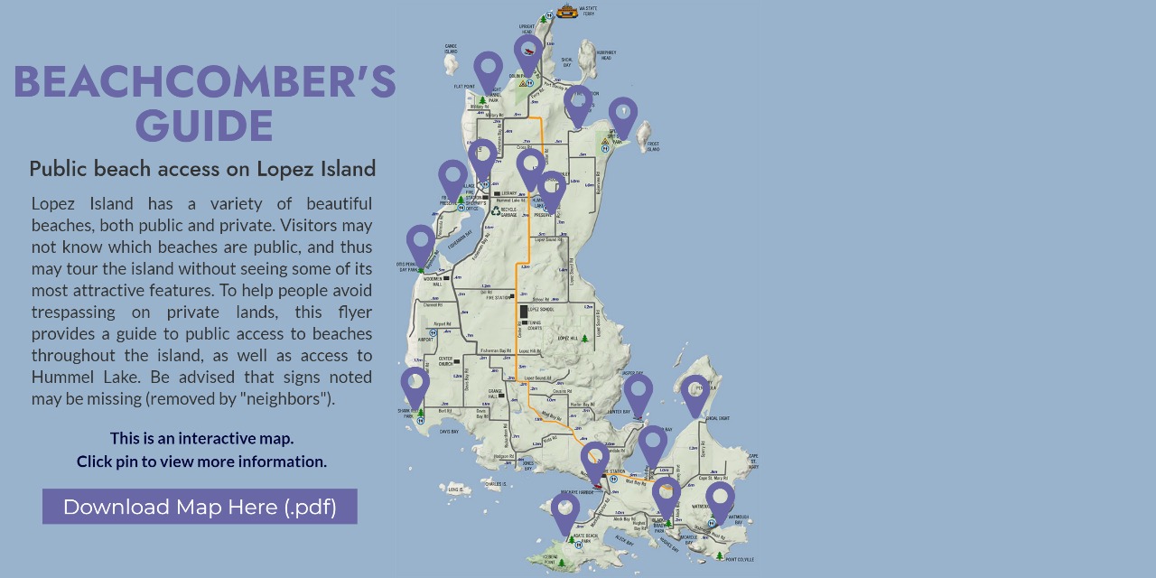
Click pin to view more information.

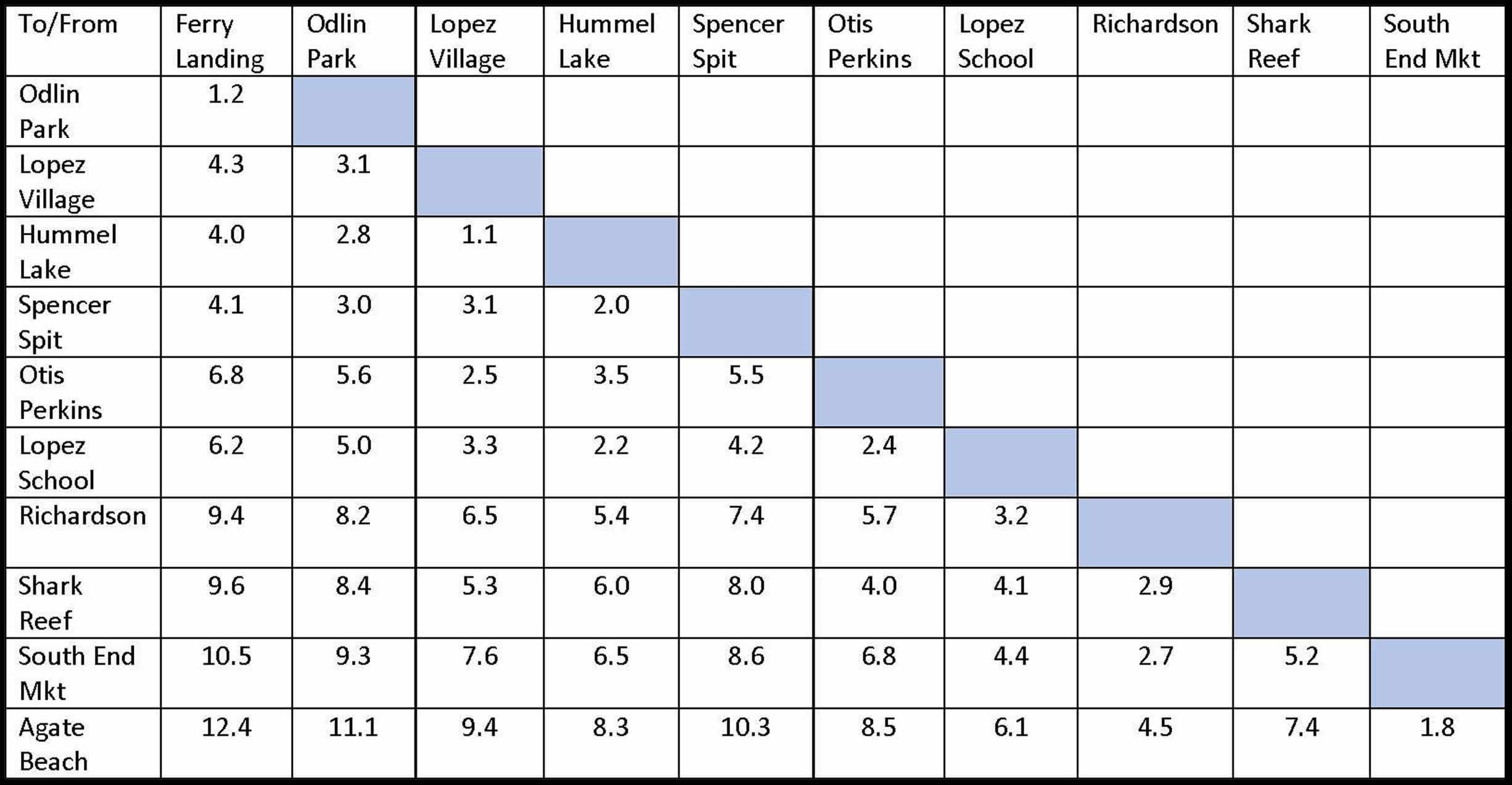
*No Shower
Next to Village Market

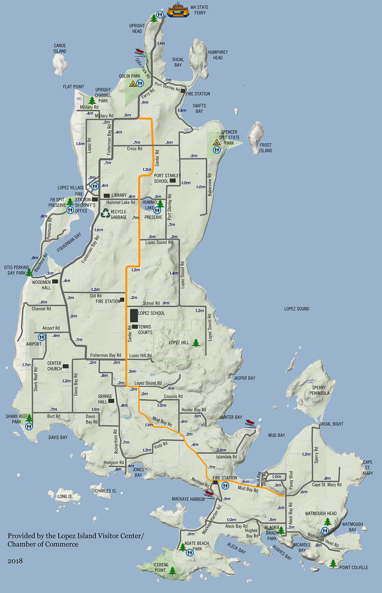
Not recommended for
Bicyclist and Pedestrians.
Lopez Sound
Strait of Juan de Fuca
Lopez Sound
*No Shower
Next to Village Market