Lopez Island Thumbnail History
By Kathryn Nass Ciskowski
Lopez Island, surrounded by the cold waters of the Salish Sea, is at 29.5 square miles the third-largest island in San Juan County. It is the first scheduled stop on the Washington State Ferry route from Anacortes that brings passengers and vehicles into what are known as the San Juan Islands. Lopez Island has fertile soil, relatively flat topography, and a mild climate. These features, along with abundant marine life, brought sustenance to Native Americans for thousands of years and to the European settlers who came later. Stable settlement of Lopez Island did not really begin until 1873, when a long-standing boundary dispute between the United States and Britain was finally settled, allowing Lopez Island to become part of Washington Territory. Farming, ranching, and fishing provided an economic nucleus for islanders as they developed other ways to make a living and form a community. Currently, tourists and seasonal residents are a regular part of island life. Lopez is sometimes called “The Friendly Isle” or occasionally, “Slowpez,” but it also can be a very busy place for residents as they commit themselves to community life, making a living, and preserving the rural character of their chosen home.
Geography and Geology
Lopez Island is located about 75 miles northwest of Seattle and is one of hundreds of islands in the San Juan Island chain. During low tide there are approximately 750 islands visible above the water line within the boundaries of San Juan County (various sources give various numbers); at high tide the number is reduced to about 430, of which only 175 have formal names. Orcas Island is the largest, at 57 square miles; San Juan Island is next at 55 square miles; then comes Lopez Island, at 29.5 square miles.
The San Juan Islands are the tops of a mountain range that formed several hundred million years ago and was shaped in part by glacial activity. They are composed chiefly of Paleozoic and Mesozoic sedimentary rocks. The islands were exposed around 14,000 years ago, after the most recent Ice Age. The mountains rise from the sea floor, and the various rock configurations shape the archipelago’s channels and harbors. The islands’ current shorelines are approximately 5,000 years old.
Coast Salish Life
Current archeological evidence indicates that human beings have lived in the San Juan Islands at least since shortly after the islands were uncovered following the last Ice Age, or some 14,000 years. For many years the Coast Salish (Lummi, Samish, Saanich, and Songhee) tribes spent winters in cedar-plank longhouses and used the warmer months for hunting, fishing, and cultivating and gathering plants. Northern tribes (including the Tsimshian, Haida, Tlingit, and Bella Bella) were aggressive and would periodically kill, capture slaves, and steal goods from more peaceful tribes. Smallpox and other diseases further decimated the tribes, and by the early 1900s they were a greatly reduced presence in the islands.
Research about Native American history in the area is ongoing. In 2004 the Burke Museum at the University of Washington, the federal Bureau of Land Management, and the Samish Tribe jointly conducted archeological investigations on Lopez. One of their discoveries was a rare intact hearth at the bottom of a Watmough Bay excavation.
European Exploration
According to a story that may be apocryphal, the first Europeans to enter local waters came on a Spanish ship in 1592 piloted by Apostolos Valerianos (1536-1602), a Greek with the Spanish name Juan de Fuca. The goal was to find the fabled Northwest Passage (a supposed water route between the Atlantic and Pacific oceans). They were unsuccessful, since no such water route existed.
Two hundred years later the Spanish returned and named many of the geographic features while mapping the area. Captain Francisco Eliza (1759-1825) chose the name Lopez for one of the islands, after his pilot, Gonzalo Lopez de Haro (d. 1823). Britain and the United States also entered the area and did their own mapping and naming. The first Lopez Island landings took place in 1792, when British Captain George Vancouver (1758-1798) on the Chatham stopped on what is now known as Point Colville and the Spanish went ashore at Watmough Head.
In 1841 the American captain Charles Wilkes (1798-1877) changed the name of Lopez to Chauncey’s Island, to honor a War of 1812 naval hero, Isaac Chauncey (1779-1840). But in 1847 the British changed the name back to Lopez Island, and that name has remained ever since.
Pig War Days
In 1843 the British established Hudson’s Bay Company in Victoria B.C., and in 1845 Great Britain publicly claimed it was in possession of San Juan Island. In 1846 the Treaty of Oregon between Britain and the United States established boundaries that were generally accepted until one small ambiguity surfaced. The border was to go through the middle of the channel on the 49th parallel, but there were actually two channels. Haro Strait was nearest Vancouver Island and Rosario Strait was closer to the mainland.
Eventually, this unclear designation led to what is known as “The Pig War.” Although the only casualty of the Pig War was a Hudson’s Bay-owned pig shot by American Lyman Cutler (d. 1874), British and American soldiers spent 12 years on San Juan Island in a joint military occupation while both claimed the territory as their own. It was not until 1872, when the dispute was settled by Kaiser Wilhelm (1797-1888) of Germany (by request from both parties), that the United States had true claim to the islands.
On October 21, 1872, the boundary was established and the military presence in the San Juan Islands dissipated. All of the earlier confusion and tension caused Lopez and the other San Juan islands to be the last part of the United States at that time to be completely available for settlement by American citizens. Some local British subjects quickly applied for U.S. citizenship so they could remain and obtain legal title to land.
Early Settlement
Although formal settlement did not begin until the boundary resolution in 1872, a few Europeans had come to Lopez Island before that time. One of these was British subject William Pattle, who arrived in 1852. He was a Hudson’s Bay employee who started a logging operation on southwest Lopez and was given the first territorial land license by the British government. After erecting a couple of structures, Pattle left for Bellingham, where he became successfully involved in the coal industry. His site on Lopez was taken over by an American, William W. Cussans (sometimes spelled “Cousins”). But Cussans was unwilling to take his lumber through Canadian customs, which caused further conflict between the two countries. The Hudson’s Bay Company attempted to give out land grants on Lopez Island to British subjects, but there was little interest; most people did not want to be so far away from established settlements.
Hiram E. Hutchinson came to Lopez around 1850 at the age of 19 or 20 and became the island’s first permanent non-Native settler. He arrived in the midst of a battle between Coast Salish Natives and a raiding party of Haida from the north, and he used his gun to help defend the Coast Salish. He was invited to stay at their village, called Sxolect, at Fisherman Bay. He entered into a tribal marriage to a Tlinglit woman, Mary, and in 1867 they had a son, Millard. During this time “Hutch” became the island’s postmaster and storekeeper, and was situated on Fisherman’s Bay. In 1873 Hutch’s sister, Irene, came to Lopez with her family to help with the store. Hutch died in 1880 or 1881.
Once Lopez was officially deemed part of the United States, it attracted settlers who were interested in starting a new life on property they were able to own, thanks in large part to the 1862 Homestead Act. Washington had become an official United States territory in 1853, and the islands then were considered part of Whatcom County. The local people wanted their own county; San Juan County was formed in the autumn of 1873. Although the county seat was located on San Juan Island, Lopez citizens were able to serve in various governmental capacities.
Another early resident on Lopez was British sailor Billy Barlow, who jumped ship, then married Lucy, a Native woman from Alaska, with whom he would have nine children. Lucy Barlow was the first woman to join the stable settlement on Lopez. Many of the non-Native male settlers who came to Lopez either lived with or married Native women, and descendants of these families still reside on Lopez today.
The first non-Indian family to settle on Lopez was that of James and Amelia Davis and their children, who arrived in 1869 as British citizens. The Davis family was community-minded and brought social and cultural offerings to fellow islanders. According to Susan Lehne Ferguson in Images Of LopezIsland, “James and Amelia loved music and reading, and their home served the community as a Sunday school, library, hotel and dispensary” (Ferguson, 18).
The Community Evolves
People came to Lopez Island for a variety of reasons — prospectors returning from various gold rushes and passing through the islands, relatives and friends of residents, respondents to advertising, those hoping for a better life. Writers extolling the virtues of Lopez Island were generous in their praise. Honor L. Wilhelm described Lopez Island in the 1901 Supplement to the San Juan Islander:
“The valleys of this island embrace acre after acre of the most fertile land under the sun and charm and delight the eye with their beautiful fields and well-kept, attractive orchards … . It is a saying that no one on Lopez, be he stranger or friend, knocks in vain when seeking food or shelter, and of all the islands the residents on this island especially appear to be prosperous and well off. The finest and largest homes and residences in the county are found on Lopez. Religions and educational facilities are of the best here … . In addition to agriculture and fruit raising, the best fishing in the State for salmon fishing is along this island’s borders …” (Wilhelm, 33).
As people moved to the island, three main communities formed: Port Stanley, Richardson, and Lopez Village. These communities all boasted steamer service, a store, and a post office. A smaller area known as Mud Bay also had a post office and a school.
Port Stanley
Port Stanley was located at the north end of the island. Over the years the town had three successive school buildings in use, from 1876 until 1941, when all the schools on the island consolidated. Port Stanley was served by a store owned cooperatively by local residents until 1914.
Frank Kilpatrick purchased the store there and added a dock. His family also operated an inn and restaurant. The Puget Sound Potash and Kelp Fertilizer Company was built at Port Stanley in 1913 and produced gunpowder, fertilizer, and iodine until shortly after World War I, when the plant closed.
Richardson
On the south end of the island was the hamlet of Richardson. George Stillman Richardson and his family came to Lopez Island around 1870 and homesteaded in the area between Jones Bay and Davis Bay. Richardson was only there a short time before he sold his land. Eventually it was acquired by William Graham, who recognized the great potential of the area, which by then included roads, the southernmost deep-water port in the county, and huge seasonal salmon runs nearby.
Led by Graham, the Richardson area grew rapidly. In 1878 N. P. Hodgson arrived on the island and worked with Graham. People cooperatively built a community hall in 1897, and the town’s many amenities ranged from a good general store to a barber shop. Richardson became a major trading center for fish and farm products and was served at one time by two daily steamers. By 1913, Richardson fishing was at its peak, with five fish traps, three canneries, and an estimated 5,000 people living there in the summer.
But after 1913 Richardson went into decline. That year a mudslide blocked a portion of the Fraser River in British Columbia, which in turn affected the local salmon run. A fire, an explosion, the outlawing of fish traps in 1934, and the Great Depression were among the factors that slowly caused the demise of Richardson. The store remained until fire destroyed it in October 1990, and Richardson was no more.
Lopez Village
Hiram Hutchinson started the first store in Lopez Village. The village continued to grow, helped by C. T. Butler, who came to Lopez in 1891 and by 1901 owned many businesses.
All of the island post offices had consolidated into the Lopez Village branch by 1953. Today (2012) Lopez Village is the only town on the island.
Farming and Fishing
Because of the mild climate, relatively flat topography, and fertile soil, Lopez Island became a farming island. By the late 1800s the island was the largest producer of agricultural products in the San Juans. People raised sheep and cattle and grew grain, fruits, and vegetables. Aside from providing for their own families, farmers shipped apples, cherries, prunes, plums, and strawberries to city markets, and during the early 1900s these brought good prices.
By 1930 there were 134 farms on the island. John Bartlett brought the first threshing machine to Lopez. Farmers would move from farm to farm, working together, to harvest the grain. Dairy farms were also profitable, and in 1906 Lopez Island got its own creamery.
Surrounded by waters teeming with salmon, the fishing industry also provided a major form of income for Lopez residents. David Richardson, in his book, Magic Islands, writes that around the turn of the century:
“In an average season forty or fifty outfits, employing more than 400 men, filled the entire bay off the southern coast of Lopez with every conceivable type of craft and took a million to a million and a half fish from the sea” (Richardson, 63).
The community of Richardson was the busiest port in the San Juan Islands during the fishing season because it was the first place where steamers coming from Seattle could land. Canneries at Richardson processed salmon caught by purse seiners, gill netters, reef nets (a method that had been used by local tribes for hundreds of years), and fish traps. Some 400 workers at a time could work at the canneries at Richardson. Included in the work force were Chinese and women. During the off-season, workers would spend their time repairing gear and preparing for the next season.
Fishing and farming were the economic foundation, but as the community grew such occupations as woodcutter, telephone operator, boat builder, seaman, teacher, storekeeper, postman, and kelp fertilizer-plant worker appeared on the census forms.
Lopez Ups and Downs
Many regional and national changes impacted the Lopez economy. Following the Fraser River mudslide came the growth of irrigation in Eastern Washington. This, and better road service on the mainland, reduced the market for Lopez fruits and vegetables delivered by steamers. The Great Depression affected Lopez Island as well as the rest of the country. Lifestyles changed, and the population grew smaller.
In the 1960s and 1970s, things slowly began to change again. Salmon fishing was briefly revitalized, tourism caught on, and urbanites looking for a different lifestyle moved to the islands. Some bought the old homesteads and brought them back to life. Others built second homes, for vacation or retirement. The “back to the land” movement of the 1970s inspired others to try an agricultural lifestyle.
Wires and Wheels
Local phone service came to Lopez in 1908, when subscribers put together the poles and wires and bought their own phones. In 1916 the Long Distance Telephone Company was started by Al Douglas, broadening telephone options. Orcas Power and Light Cooperative (OPALCO) was formed on Orcas Island in 1937 to bring electricity into the San Juan Islands. Service came to Lopez on January 1, 1942, when a diesel power plant was installed. A significant upgrade occurred with the installation of a substantial submarine cable from Anacortes. Some 700 people attended the dedication celebration on July 22, 1951. OPALCO continues to maintain and upgrade its systems as new technology and resources become available.
For years it was easier to move around the island by boat rather than road. Steamer ships (the famous “mosquito fleet”) connected Lopez Island to the mainland and served the island for many years. A highly respected captain of these ships was Sam Barlow, son of one of the earliest Lopez settlers, Billy Barlow.
In the 1920s, after the mosquito fleet, came the Puget Sound Navigation Line (also known as the Black Ball Ferry Line), which provided car-ferry service to the Lopez ferry terminal at Upright Head. In 1951, the Washington state ferry system purchased the line and continues to serve the community today (2012). Scheduled air service arrived in 1947, when Roy Franklin and Bob Schoen began operation of Island Sky Ferries. November 5, 1968, saw the creation of the Lopez Port District.
Community Life
Early Lopez Island residents enjoyed leisure activities such as baseball, a community band, picnics, quilting bees, and participation in benevolent groups. The general stores were often both business and social centers.
The beauty of the island has long been an inspiration for artists. Two highly respected Northwest artists, sculptor James Fitzgerald (1910-1973) and painter Margret Tomkins (1916-2002), built a home on Lopez in 1948. After Fitzgerald died in 1973, Tomkins moved permanently to Lopez. In her oral history interview for the Smithsonian’s Archives of American Art, she described a point in her early Lopez life when she was able to barter fish for art:
“I’d do watercolors of the purse seiners and then row out and they’d throw me some fish and I’d give them the painting” (Tomkins interview).
Today more than 44 island artists participate in the yearly artist-studio tour. Many island shops feature their creations. Music and theater are also valued aspects of Lopez life.
Faith and Education
Religion has long been a part of island life. Center Church was dedicated on August 4, 1889. Methodists and Congregationalists had a joint use agreement, which set a precedent for its multi-denominational use today. The Grace Methodist Church was founded in 1954 and also remains in use (2012).
The first official school teacher on Lopez Island was a Mrs. Thompson, who was hired in 1872. From that time on Mud Bay, Port Stanley, and Lopez Village each had a small school that was rebuilt as needed over the years. The district consolidated into one school, located on Center Road, in 1941. The Lopez village school house, which opened on May 20, 1895, has been remodeled and, after some other uses, became the Lopez Library in March, 1977. The last Port Stanley school building has also been remodeled, and was donated to the Historical Museum for community events. The old Center School is now in use as the Grange hall.
Crime on the Island
The first person buried in the Lopez Union Cemetery was a murder victim, John Anderson. He was shot by his neighbor, John Kay, in May 1882, after a cow belonging to Anderson wandered onto Kay’s property. When Anderson came to retrieve it, Kay shot him.
The most notorious crime on Lopez Island in recent years was perpetrated by Ruth Nesland, who murdered her husband Rolf Neslund on August 8, 1980. She was convicted of shooting him and then burning the body. This was one of the relatively rare convictions in the United States in which a body was never found. Ruth Neslund died in prison at the age of 73 on February 17, 1993.
Henderson Camp/Camp Nor’wester
In 1935 Frank Henderson started San Juan International Camp on San Juan Island. The idea was to bring boys from Canada and the United States together to have an experience similar to a Boy Scout camp. In 1938, Henderson and his, wife Lucille, opened the camp to girls as well.
In 1946, they purchased 320 acres on Sperry Peninsula on Lopez Island and moved the camp there, changing its name to Camp Henderson. Upon their retirement in 1967, new owners called it Camp Nor’wester. Campers from many eras were saddened when, due to financial difficulties, the land had to be sold. In 2000 Camp Nor’wester reopened on Johns Island near San Juan Island. The Sperry Peninsula property is now owned by Microsoft co-founder and philanthropist Paul Allen.
Lopez Through the Census
The 1870 federal census counted 70 people on Lopez. That increased to 180 in 1880 after it had become possible for United States citizens to legally acquire land. Each subsequent census showed a population increase until 1930, when the numbers showed a decrease from 750 in the 1920 count to 575 in 1930.
In the early days, most of the residents were listed in the census as farmers or fisherman, but as the population grew new professions such as teacher, telephone operator, and kelp harvester appear. The 2010 census counted 2,383 people on Lopez Island, with the largest demographic group being in the 60-64 age range. The census counted 2,410 housing units, split roughly evenly between year-around and seasonal occupancy.
Lopez Today
Just as in the past, Lopez Island continues to be a hospitable, pastoral community. There are no incorporated towns on the island, and local governance is handled by elected San Juan County officials and their agents. The county seat is in Friday Harbor on San Juan Island.
Many Lopez citizens are active in civic and community affairs, and the spirit of collaboration has resulted in land-use planning, affordable-housing projects, maintenance of community buildings, fundraisers, and support for neighbors in need. Celebrations and festivals are included in the fabric of life.
In addition to the ferries, Lopez also can be accessed by private boat or plane. Boating, hiking, golfing, beachcombing, tennis, biking (very popular due to the relatively flat terrain), and whale and wildlife watching are readily accessible. Among other attractions are a summer Farmer’s Market, a July 4th celebration, the Tour de Lopez bicycle ride, a winter festival, and tours of homes and artist studio.
On the south end of the island is the unique Islandale Store. Shops specializing in local arts and crafts, a variety of restaurants (many focusing on locally produced food), the Lopez Island Vineyards and Winery, and many different kinds of accommodations (including camping, resort, B and B’s, rental houses) are available. Lopez Village (located on Fisherman Bay) is the hub of economic activity, with access to grocery stores, a post office, a bank, a pharmacy, a thrift store, boutiques, and bakeries.
Eight county parks and one state park (Spencer Spit) on the island are open to the public, and a thriving community center provides a home for many different events. This is also true of the Lopez Library, Lopez Family Resource Center, Lopez Island Historical Museum, Woodmen Hall, and local churches. Lopez even has its own radio station, KLOI.
Although locals still farm and fish, it is on a much smaller scale than in the past. Now tourism, construction, arts-and-crafts, small businesses, telecommuting, and working for schools or other community organizations are some of the ways that current island residents make a living. Lopez Island is still noted for being friendly and local drivers will often share the relaxed lifted-hand “Lopez Wave” as they pass oncoming vehicles.
Sources:
HistoryLink.org Online Encyclopedia of Washington State History, “Friday Harbor” (by Margaret Riddle), and “San Juan County” (by Kit Oldham), and “San Juan Island Pig War — Part 1” (by Kit Oldham), and “San Juan Island Pig War — Part 2 (by Kit Oldham), and “Lopez Island voters approve formation of port district on November 5, 1968” (by John Caldbick), and “San Juan Island Pig War” (by Rebecca Smith, History Day Award Winner), and “Britain cedes its claims to the Pacific Northwest by signing the Treaty of Oregon on June 15, 1846″ (by Walt Crowley), and Lyman Cutlar touches off Pig War between U.S. and Great Britain on June 15, 1859” (by Kit Oldham), and “Ferry Whistles on Puget Sound: A Slide Show” (by Alan Stein), and “Turning Point 9: The Sound and the Ferry: The Birth of Washington State Ferries” (by Alan J. Stein and the HistoryLink.org staff), and “Ruth Neslund murders her husband, Rolf Neslund, on Lopez Island on August 8, 1980” (by Daryl C. McClary), http://www.historylink.org/ (accessed November 25, 2012); Brian Cantwell, “The Laid-back Pleasures of Lopez Island,” The Seattle Times, July 29, 2012 (http://seattletimes.com); Jayson Jenks, “Lopez Island of Dreams,” Ibid., November 24, 2012 (http://seattletimes.com); David Richardson, Magic Islands (Eastsound: Orcas Publishing Company, 1973), 28, 62-65; Don Pitcher, San Juan Islands(Berkeley: Avalon Travel, 2012), 212-234; “The Lopez Island Community,” Lopez Rocks website accessed November 26, 2012 (http://www.lopezrocks.org); “Grace Episcopal Church” Grace Episcopal Church website accessed November 3, 2012 (http://gracelopezisland.org/); “Explore OPALCO’S History,” OPALCO website accessed Nov. 1, 2012 (http://www.opalco.com/history/); “About Lopez Island,” Lopez Island Chamber of Commerce website accessed November 4, 2012 (www.lopezisland.com); “Official Travel Guide of the San Juan Islands,” Visit San Juan Islands website accessed November 12, 2012 (www.visitsanjuans.com); “San Juan County Parks,” San Juan County website accessed November 15, 2012 (www.co.san-juan.wa.us/parks); “About Us,” KLOI,102.9 FM website accessed November 27, 2012 (http://www.kloi.org/about-us/); “Camp Nor’wester,” Camp Nor’wester website accessed November 27, 2012 (www.norwester.org); “Zip Code 98261,” Zipcodes.com website accessed October 30, 2012 (http://www.zip-codes.com/zip-code/98261/zip-code-98261.asp); “San Juan Island,” National Park Service website accessed October 30, 2012 (http://www.nps.gov/sajh/historyculture/the-pig-war.htm); Joan W. Coffelt and Robert J Coffelt, Time and Lives of Some Coffelts in America, (Davis: Coffelt Publishing Co.,1995), 139; Lucille S. McDonald, Making History: The People Who Shaped the San Juan Islands, (Friday Harbor: Harbor Press, 1990), 9-17; Honor L. Wilhelm, “”Islands Illustrated,” Supplement to the San Juan Islander,” The San Juan Islander,1901, 33-41; “Lopez Island,” Washington Rural History website accessed November 25, 2012 (http://www.washingtonruralheritage.org/cdm/search/searchterm/lopez{f190a2e6adb605d7af9810e1834029395a0c7298e4637697a7141e0e0fa85e1a}20island/order/nosort); Susan Lehne Ferguson and the Lopez Island Historical Society and Museum, Lopez Island: Images of America (San Francisco: Arcadia Publishing, 2010); “Washington State Ferries History,” Washington State Department of Transportation website accessed November 28, 2012 (http://www.wsdot.wa.gov/Ferries/yourwsf/History.htm); “Northwest Homesteader” Center for the Study of the Pacific Northwest website accessed November 28, 2012 (http://content.lib.washington.edu/curriculumpackets/homesteaders/intro.html); Gary Morris, “Lopez Island History,” Ancestry.com website accessed November 2012 (http://freepages.history.rootsweb.ancestry.com/~lopezislandhistory/); “Lopez Island Library History,” Lopez Library website accessed November 18, 2012 (http://www.lopezlibrary.org/); Sheila Farr, “Outspoken Seattle Painter Margaret Tomkins Dies,” The Seattle Times, March 22, 2002 (http://community.seattletimes.nwsource.com/); Susan Bynes, “Paradise Lost — Camp Closes, But Spirit Stays,” Ibid., August 20, 1996 (http://community.seattletimes.nwsource.com/); The Lopez Island Historical Society and Museum Newsletters: Autumn 2003, Summer 2005, Spring 2006, Spring 2007, Spring 2009, Fall 2009, Spring 2011, (http://lopezmuseum.org/); “Oral History Interview with Margaret Tomkins, 1984 June 6,” Smithsonian Institution Archives of American Art website accessed November 29, 2012 (http://www.aaa.si.edu/collections/interviews/oral-history-interview-margaret-tomkins-12308); Roy Davidson Mclellan, The Geology Of The San Juan Islands (Seattle: University of Washington Press, 1927); “14,000-year-old Bison Skull Found on Orcas X-rayed for Stone Weapon Fragments: New Slideshow,” Islands’ Sounder website accessed May 6, 2013 (http://www.islandssounder.com/news/95810309.html?mobile=true).
Note: This essay was revised on May 6, 2013, and on February 16, 2017.
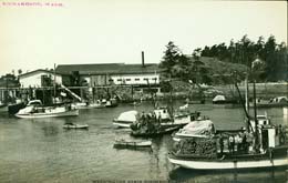
Richardson Bay, Lopez Island 1910
Postcard, Courtesy Washington State Historical Society (Image No. 2000.93.3)
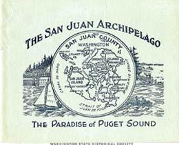
Booklet with San Juan County map, 1909
Illustration by O. H. Culver, Courtesy Washington State Historical Society (Image No. S1991.36.74)
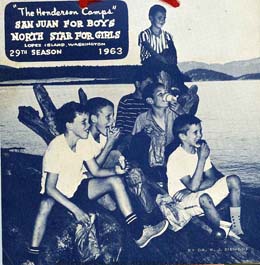
Promotion for Henderson summer camps for boys and girls, Lopez Island, 1963.
Courtesy Washington State Historical Society (Image No. 1999.1.356)
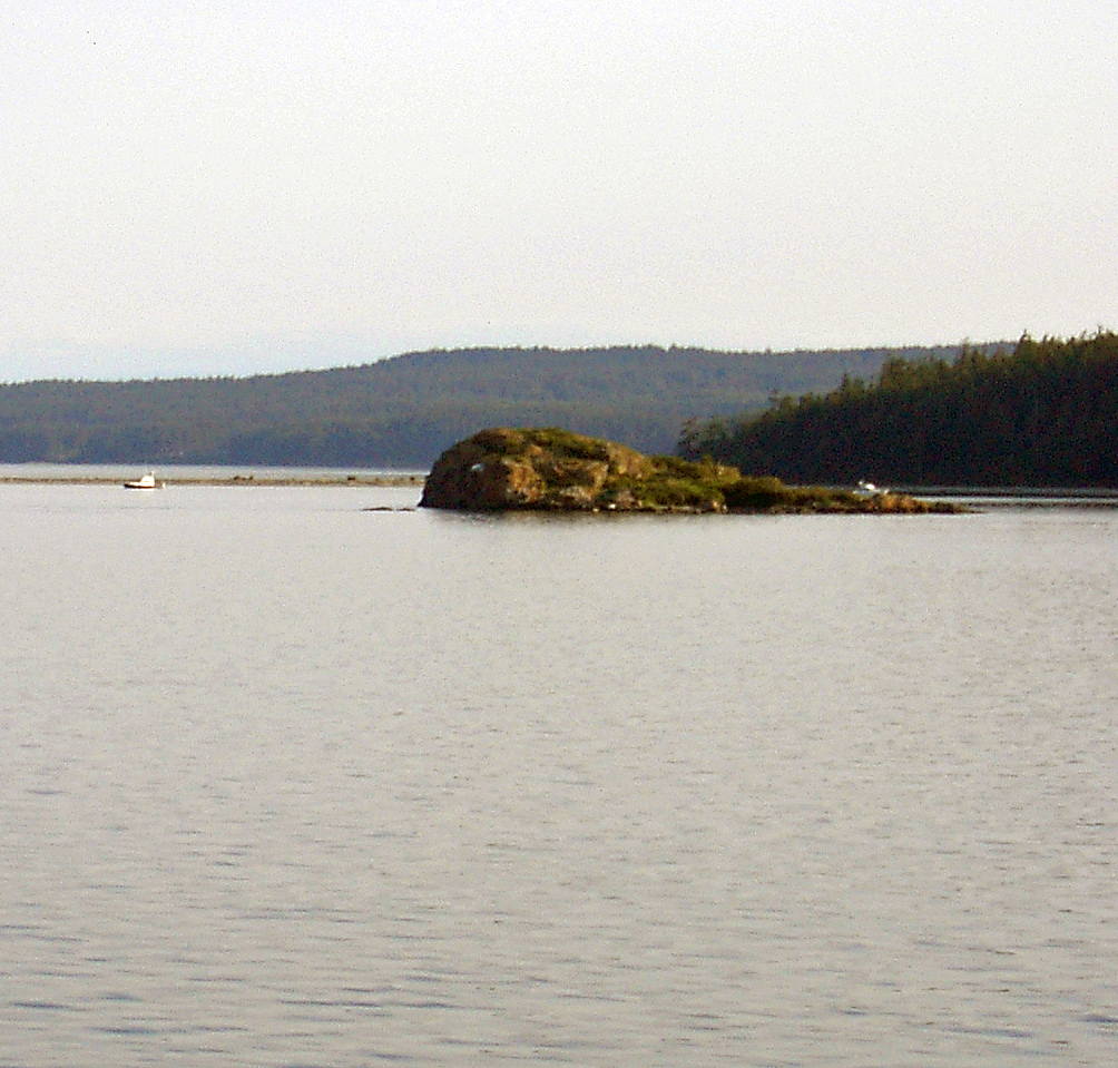
Flower Island with Spencer Spit and Lopez Island in background, June 2, 2003
HistoryLink.org Photo by Kit Oldham
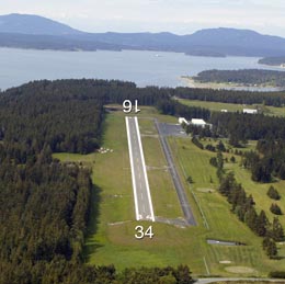
Lopez Island Airport, Lopez Island, 2009
Courtesy Washington State Department of Transportation

Lopez Island Library, 2013
Photo by Kathi Ciskowski
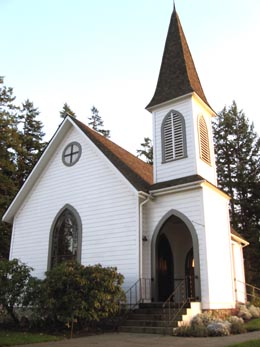
Center Church, Lopez Island, 2013
Photo by Kathi Ciskowski
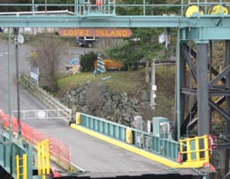
Lopez Island ferry landing, 2013
Photo by Kathi Ciskowski


